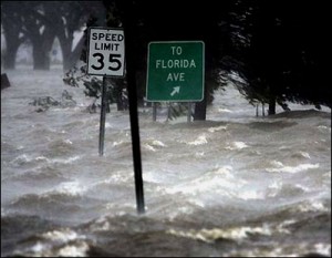
 When most people think of flooding it’s probably a coastal image that comes to mind, with either Florida or Louisiana getting battered by a hurricane.
Yet flooding can happen just about anywhere, such as a river overflowing its banks or a California mudslide sweeping everything away.
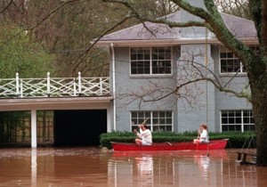
Poor drainage systems, rapid snowfall, snowmelt or problems with a levy can all add up to a homeowner suddenly feeling like a biblical Noah, even for those who might not consider themselves at risk. In fact, people outside of high-risk areas receive one third of disaster assistance for flooding and file more than 20 percent of claims under the National Flood Insurance Program.
Anytime a flood does happen, regardless of its cause, homeowners can be left with a soggy home and a dried up bank account if they’re unaware that a standard homeowners insurance policy
doesn’t cover floods. It takes a flood insurance policy backed by the Federal Emergency Management Agency to make sure they’re financially protected for when the waters rise.
Another misperception is what exactly constitutes a flood. As far as flood insurance is concerned, a flood is defined as rising waters that cover two or more acres or two or more properties of normally dry land from an overflow of inland tidal waters, the unusual and rapid accumulation of surface water runoff or a mudflow. Damage from falling water or slashing winds doesn’t count.
 Survivors of Hurricane Katrina discovered this the hard way when the issue became a question of whether homes were more damaged by flooding or wind.
Insurance companies tended to blame damage on flooding, which was not covered by regular homeowner’s policies.
Butch Kinerney, spokesman for FEMA’s flood insurance program, says his agency stayed out of that debate and simply paid on flood insurance policies for homes that were damaged by water.
“We didn’t try to draw straws between whether the flood knocked it down or the wind knocked it down,” Kinerney says. “If it was gone and if it was obvious that there was a flood there we made the assumption that the flood knocked it down.”
Kinerney says those without flood insurance had a hard time collecting on a homeowner’s policy when one of their neighbors was collecting on a flood insurance claim—the insurance companies used flood insurance claims as evidence that damage in the neighborhood was caused by flooding rather than wind.
New flood maps
 Flood insurance has been in the news in recent years for more than just claims over Hurricane Katrina, for FEMA has been updating its old flood maps since 2003. As a result, many homeowners have to buy flood insurance for the first time while others are catching a break by being changed from a high to a low risk designation.
The old flood maps were created in the 1980s, using data collected in the 1950s from the U.S. Geological Survey. Since those maps were created, improvements in mapping technology allow for greater detail and more accuracy, which can change where the flood zones are drawn. In hurricane-prone areas, the old maps were based on expected storm surges whereas the new maps also take rainfall patterns into account.
Kinerney says the greatest impact on flood zone changes comes from vacant lands being developed, although other factors are considered such as changes to storm levees and from altered weather patterns as a result of climate change.
“Are you really going to change that map because of climate change or are you going to change it more dramatically because you’ve placed a Sam’s Club and a Lowe’s and all the associated parking lot that goes with it?” Kinerney says. “All of a sudden all of that asphalt now runs into the neighborhood across the street where it used to drain into the cow pasture.”
He says FEMA is also looking at hydrology, or how water moves within a system. A coastal area is more likely to have a surge of water, which puts pressure on the outside of a building, whereas inland parts of the country are more likely to see a slow rise and California hillsides can have problems with mudslides.
Part of this updating involves gathering data from local officials and giving them a chance to respond to any proposed map changes. This allows FEMA to take local information into account and helps make people aware of potential changes to their flood zone designation.
“There are people that just have no idea about risk. There are people who know about the risk but they’re taking the gamble and then there are people who think they may be covered already by their homeowner’s insurance because you see that a lot,” Kinerney says. “We’re trying to help people understand that there might be a risk even though you may have lived there for 30 years and never had a flood.”
Kinerney says there hasn’t been a noticeable shift in the number of areas added to or removed from flood zones, as the mapping changes have more to do with improving the accuracy and level of detail.
Getting a lower rate
 Anyone with a federally backed mortgage who lives in a flood zone must buy flood insurance. Those whose designation changes from a flood zone to a safe area will no longer have to buy flood insurance, although if they choose to maintain a policy they’ll be eligible for a Preferred Risk Policy at a lower rate.
While homeowners facing a change from a safe zone to a flood area will have to pay more for flood insurance, they can save money if they buy a policy before the new flood map for their area goes into effect, as they can lock in a lower rate for one year under a PRP.
Kinerney estimates that someone buying the maximum coverage of $250,000 for the building and $100,000 for its contents would pay $405 per year under a PRP, but that same policy would cost $2,930 for a residential high-risk area.
For this reason, he says FEMA recommends that anyone facing a change from a safe area to a flood zone should buy a flood insurance policy right before a new map goes into effect, so they can make the most use of that lower premium.

